2008.009.0003
Map
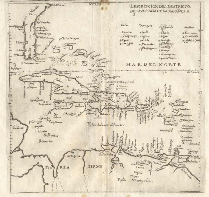
Archive Item
Descripcion Del Destricto Del Audienca De La Espanola
2008.009.0003
1601
Print of a map from a copper engraving by Antonio de Herra y Tordesillas from "Novus Orbis, sive Descrptio Indiae Occidentalis". This map was first published in Tordesillas’ official 1601 history of Spain’s achievements (Historia general de los hechos de los Castellanos). It depicts the area controlled by the “audiencia” of Hispaniola, or Santo Domingo. The audiencia was the principal governmental and judicial body for that area of the Spanish colonies. It ranges from southeastern North America and The Bahamas, into the Caribbean, and down to the Tierra Firme region of mainland South America. The cartography is based on the manuscript charts of Juan Lopez de Velasco (c. 1575-80), and despite its relatively crude execution, the map is accurate and detailed. Many of the place-names shown on the map are still in use today, a reminder of how Spain’s early colonial system shaped the modern Americas.